The roads less travelled: The shapeshifting glories of Britain’s sea paths
Roger Morgan-Grenville celebrates the joys of wandering along the evanescent byways revealed by our tides.

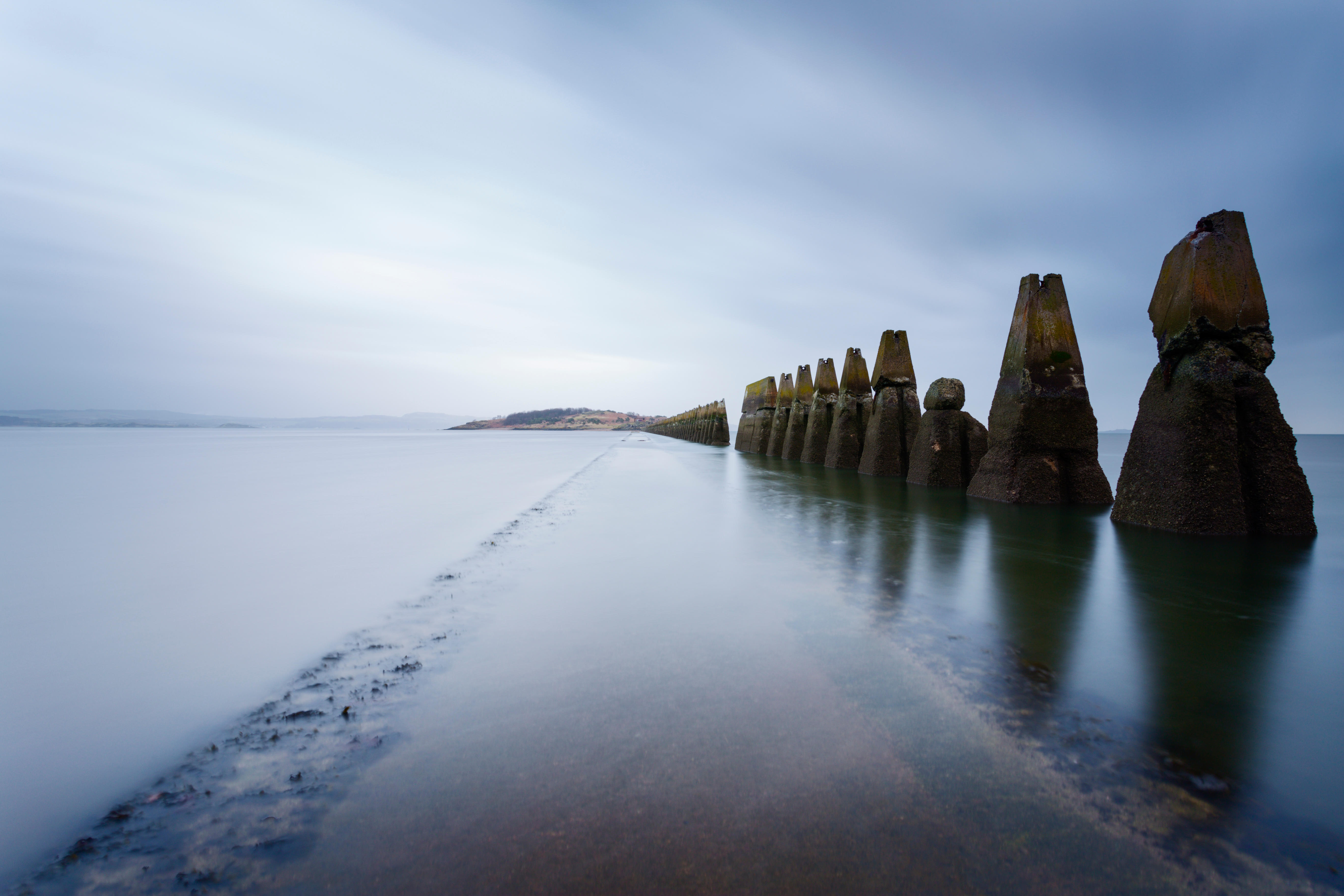
'Wilderness,’ said the American essayist Edward Abbey, ‘is not a luxury, but a necessity of the human spirit.’ He was right — and there is no wilderness like the wilderness of wet sand all around you.
Depending on where you draw the upper limit for an island, Britain is the ninth largest in the world with, according to some reports, the 13th longest coastline. However, it is only when you come to understand that, thanks to our huge average tidal range, we have the largest intertidal area of any island on Earth that you begin to grasp the sheer magnitude of the ‘land in-between’ — the land that is neither wholly wet nor wholly dry. Our estuaries alone extend to more than 2,000 square miles, an area only slightly smaller than Devon. Variously dotted with starfish, snipe, sea defences and sandcastles, it is an ethereal, shapeshifting habitat that has tempted and fascinated us since time immemorial. Walking, for some of us at least, has become the true way to see it.
Generally, we cross the sea on foot for one of three reasons: to get to a tidal island, to take a short cut or out of sheer curiosity. In the act of making that crossing, we are putting our lives in the hands of the accuracy of the tide tables (and, importantly, of our reading of them) and articulating a deep innate faith within us that there won’t be some natural disaster that pulls us helplessly out into the impatient sea.
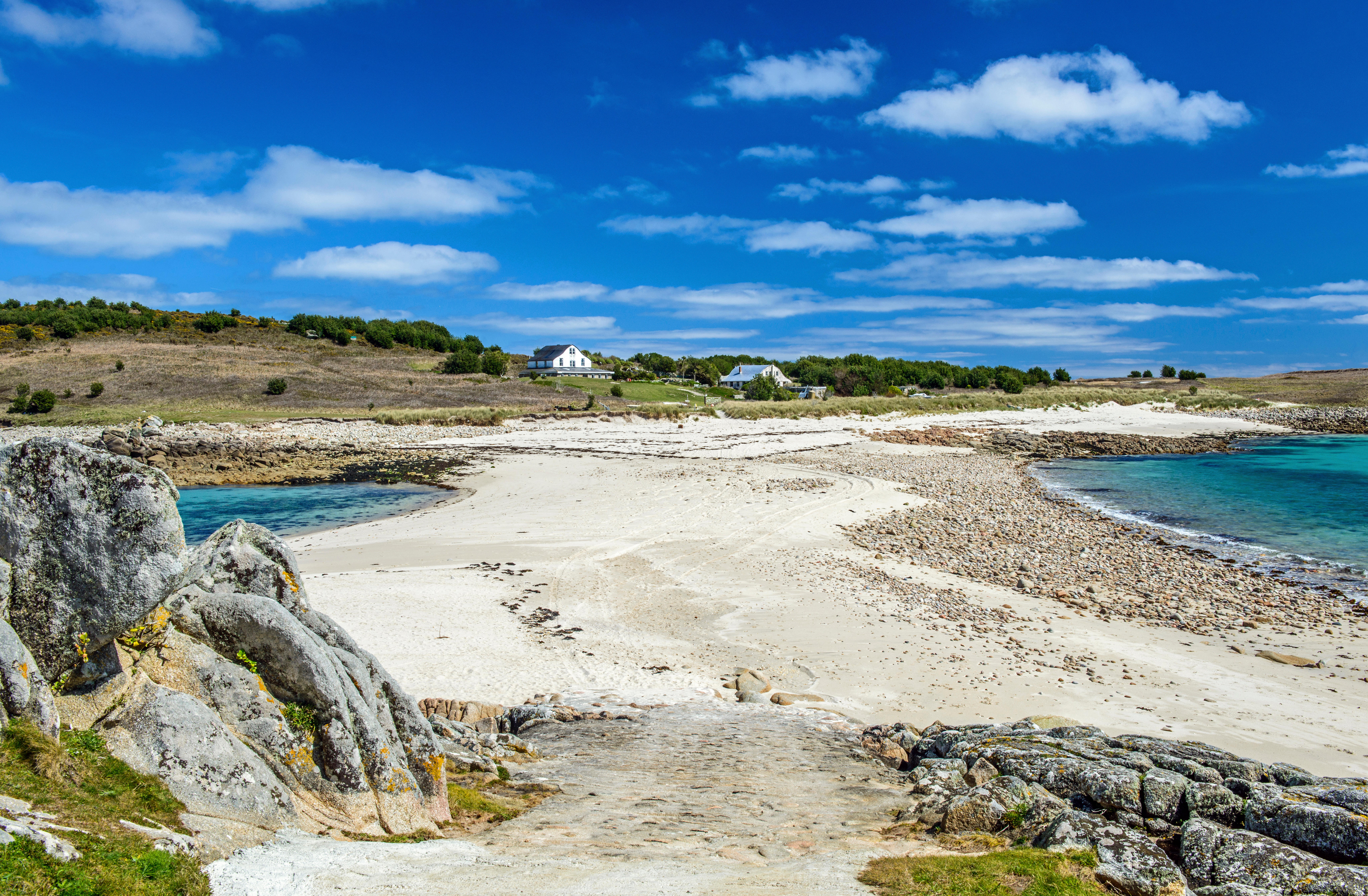
The Bar separates the islands of Gugh and St Agnes on the Isles of Scilly, depending on the tide.
I first became fascinated by tidal islands, of which we have 43 principal examples off the British coast, during childhood holidays on the Isle of Mull. I was reading Kidnapped one evening in front of the fire when my grandmother idly mentioned that Tràigh Gheal beach on the nearby island of Erraid was supposed to have inspired Robert Louis Stevenson. She wasn’t a great one for health and safety, my grandmother, so it was the work of a moment to persuade her to let this rather dippy 11-year-old child cycle down to Fionnphort on his own and try the tidal crossing for himself with no more than a copy of the Ross of Mull tide tables in the pocket of his shorts. Having made the crossing, I exulted for an hour or so in the sensation of otherness, aloneness and adventure that my new island life provided me, until the trickle of incoming saltwater started to become rather more of a flood than a trickle, and I made my wet, but happy way back to my bike and the road home. The die was cast: I had tasted the honeydew of a life in between.
Years passed and I gradually ‘collected’ half of the remaining tidal islands, generally by happening to find myself in the vicinity rather than deliberately planning the visit. The names tripped off the tongue as if from Gothic novels: Agatha Christie’s Burgh Island in Devon, St Michael’s Mount in Cornwall and Scolt Head in Norfolk. For Hilbre Island in the Dee estuary, the excuse was wader watching; for Gugh in the Scillies, it was bona fide seabird research; for Cramond Island near Edinburgh, it was all about native oysters. In North Uist, I walked 10 miles out of my way to cross the sands to Vallay and 10 miles back, simply because I had seen a picture of it on a postcard for sale in Lochmaddy.
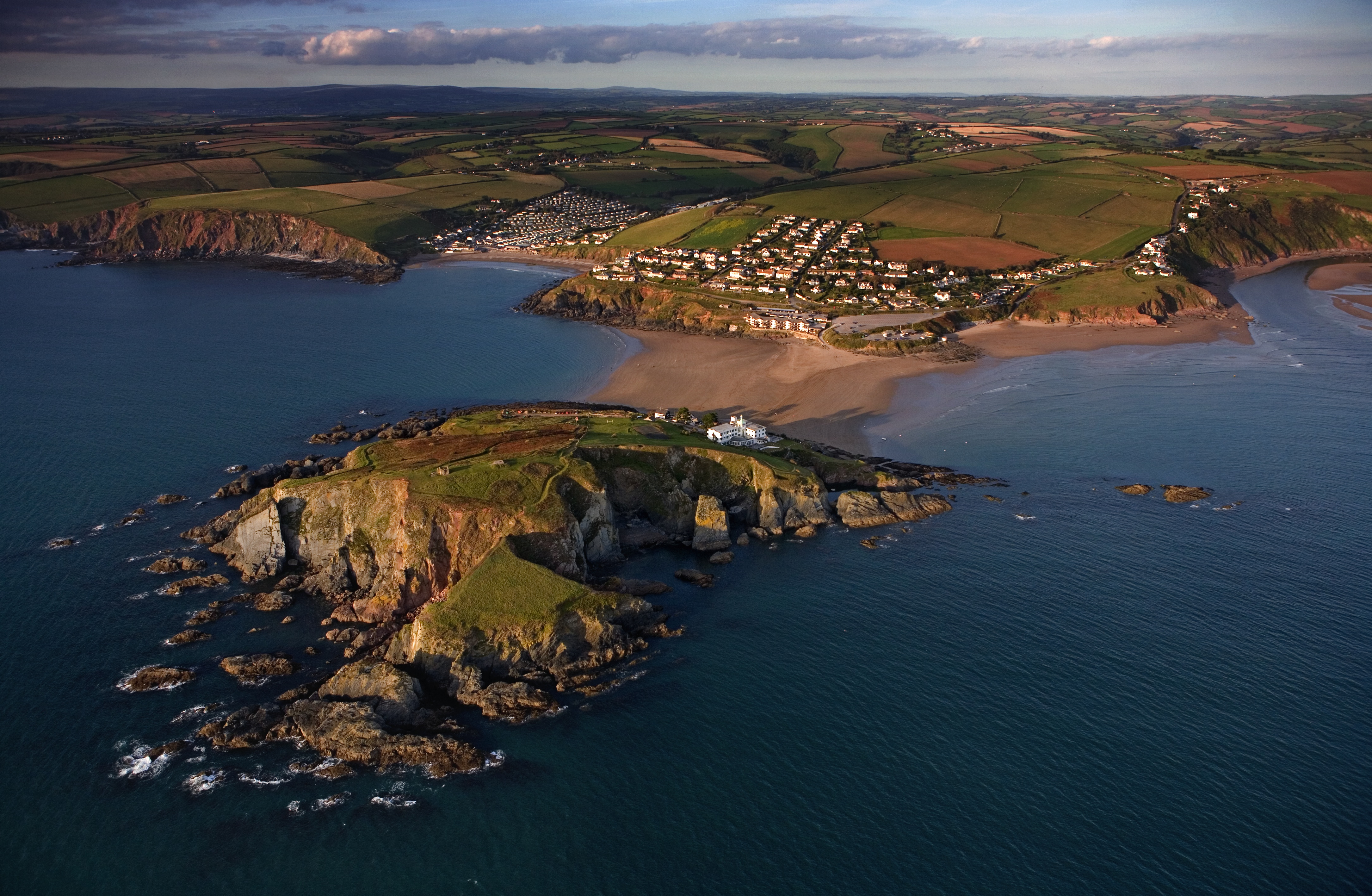
In Cornwall, on the south Devon coast, the village of Bigbury on Sea is separated from Burgh Island by a wide sea path.
Possibly the best-known sea path of all is the final three-mile stretch of the Pilgrim’s Way onto the holy island of Lindisfarne. For 13 centuries, from the establishment of the monastery in AD635 until the causeway road was opened in 1954, this was the only way onto the island for those who didn’t have access to a boat: where your feet now tread, so trod before you monks, traders, illustrators of manuscripts, Viking raiders, pilgrims and penitents. The sense of personal insignificance brought about by your place in a millennium-long line of similar travellers is good for you. These days, we have tide tables, weather forecasts and a long line of marker posts to guide us; back then, I suspect that it was more about faith in the creator and a gutful of common sense.
From personal experience, the best time to walk to Lindisfarne is early to mid morning, ahead of a midday low tide, for it is then that the flat ‘artist’s light’ creates possibly the best visual backdrop for a personal pilgrimage. Soundless save perhaps the chittering of a passing whimbrel or the piping call of some foraging oystercatchers, you are free to create around you a temporary sense of otherness that has become almost impossible to achieve in the busy world outside. Everything around you except the looming island ahead is in the horizontal plane, distance hard to judge and mirages shimmering in the background. Largely, you will be on your own, as the vast majority of the roughly 650,000 annual visitors to Lindisfarne drive over the tarmac road on the nearby causeway, but the people you may meet on their return journey will likely be adventurous souls like you and will see and treat you as one of a band of brothers or sisters rather than merely another tourist heading for yet another coffee shop.
Exquisite houses, the beauty of Nature, and how to get the most from your life, straight to your inbox.
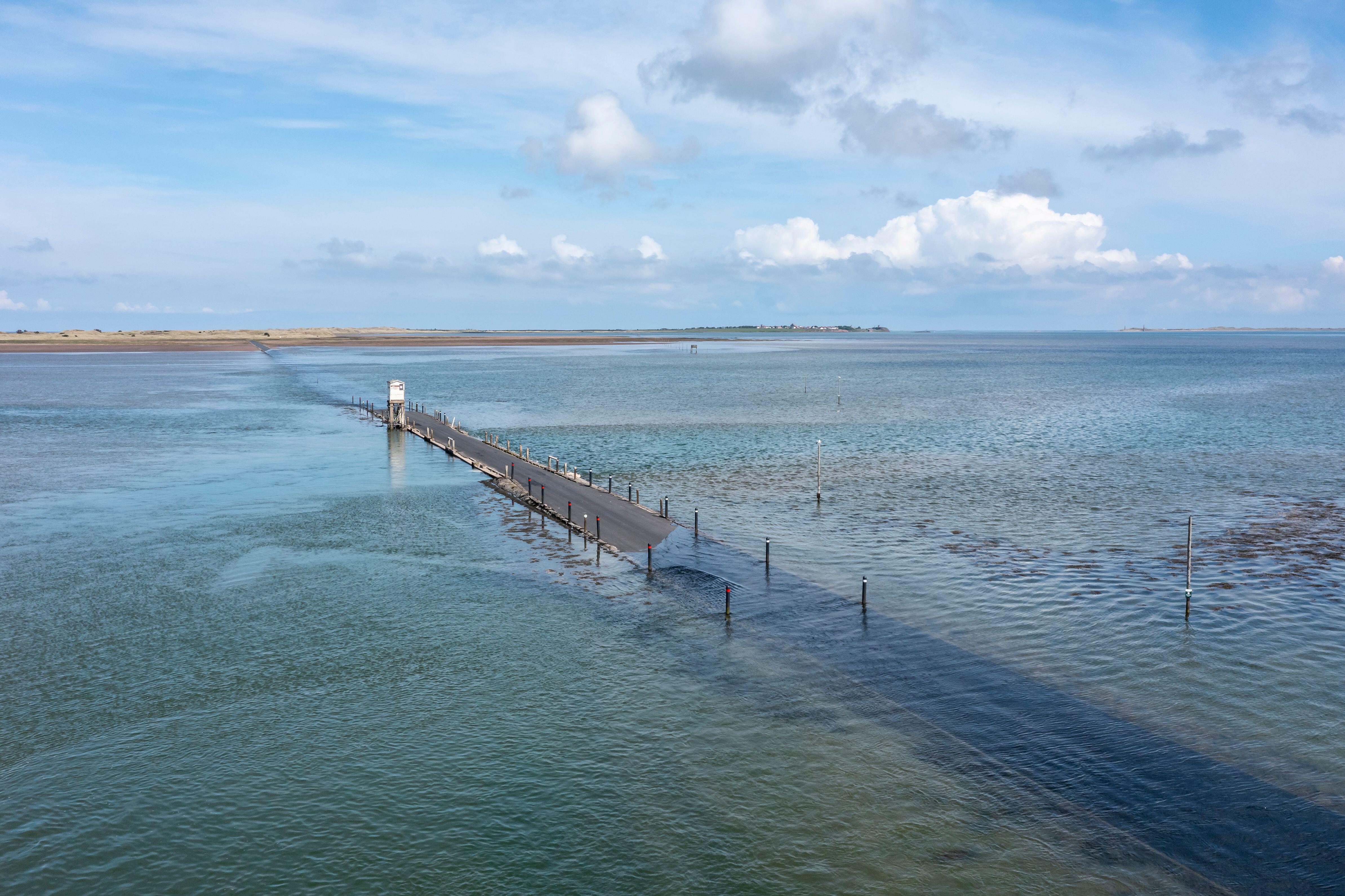
A trip to Lindisfarne can be deadly if timed incorrectly.
We have all taken simple short cuts across bays at low tide, for it is the nature of a bay to be a semicircle of sand between two headlands; doing so is almost a rite of passage within an annual seaside holiday. The godfather of these short cuts is the one across the vast expanse of 120 square mile Morecambe Bay, where professionally guided walks that are available at the northern end are in sharp contrast to the terrible (and completely avoidable) events of the night of February 5, 2004, when 23 Chinese cockle pickers were trapped and drowned by the incoming tide. One-off tragedies should not necessarily change the course of centuries of adventurous spirit, but their lessons should be vigorously taught. The sea can be dangerous and tides move fast and relentlessly over flat expanses of mud.
In the end, it was sheer curiosity that drove me to walk Britain’s most celebrated sea path, the six-mile Broomway that stretches from the Great Wakering Steps in Essex to Foulness Island, so called because the path was once marked by a series of upturned brooms. For at least 500 years, before the bridge to the island was built in 1922, the Broomway, now known cheerfully in some quarters as ‘Britain’s deadliest footpath’, was the only way that people could access the place by foot. To this day, no one can really say if the ridge, which runs 400 yards or so parallel to the shore, is a natural one or the result of centuries of human effort, but it doesn’t really matter. More than 100 people are thought to have met their end through misjudging the tides or, more likely, becoming disorientated in the mist and heading for the only visible lights, which happen to be on the far, Kentish shore.
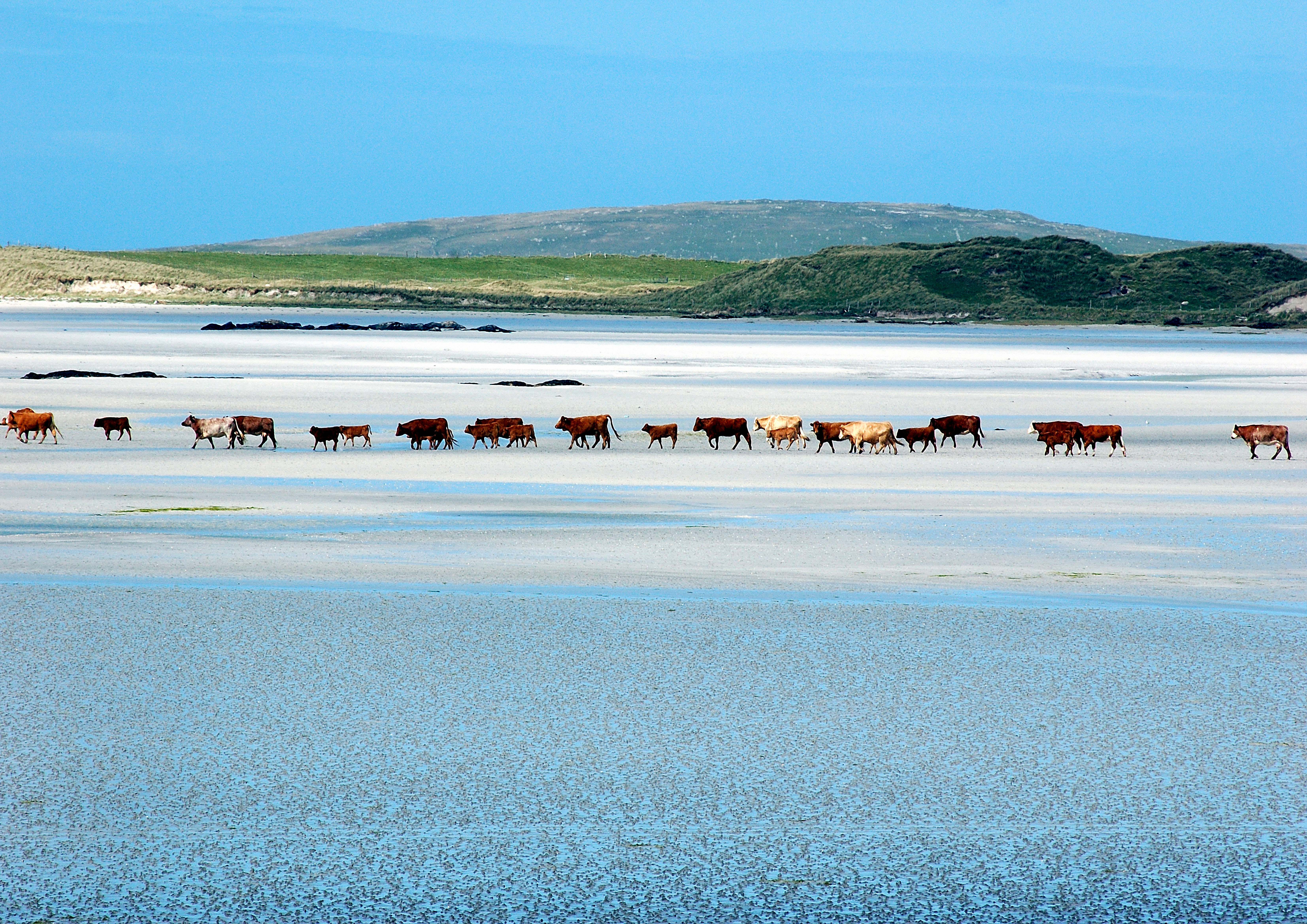
It's not only people that use sea paths to cross from one place to another, especially in Uist, Scotland.
For safety, I went with a guide and a handful of others, a group that included a commodity trader equipped for an assault on Everest, a lady from Vancouver in head-to-toe pretty pink and quite the ugliest dog that I have ever clapped eyes on. In water that was never less than a couple of inches deep, but never more than six, we were led eastwards across the flat expanse of Maplin Sands, as Kevin the guide told us the stories that we had all come to hear. It is only in the past 100–150 years that our coast has become a place of relative safety, so it was striking to listen to tales of essential night journeys across the sand, of smuggling and of shipwrecks, but also to confirm for ourselves once again the deep cultural ties we have lost with what went on in these places before. Back then, this was all someone’s workplace; these days, it is a pleasant morning’s stroll.
Sea paths have always helped to keep me in touch with my inner seafarer and rekindle the flame of my endless fascination with the liminal edgelands of our solid island. To walk through water, with sea on either side of you, is to gain a deeper and more useful knowledge of what it is to be an islander, something Sir Antony Gormley tries to explain in his giant installation on Crosby Beach, Merseyside, Another Place.
‘You can’t cross the sea,’ said the Bengali philosopher Rabindranath Tagore, ‘merely by standing and staring at the water.’ Precisely. Sea paths stand proud as a beacon of hope at a time where the search for adventure has been remorselessly compromised by one generation applying its own selfish sense of hyper-caution on the next. Long may we celebrate them.
Roger Morgan-Grenville is a former solder, writer and wildlife guide. He led the first expedition to retrace Shackleton’s escape across South Georgia and is a founder member of Curlew Action. His book The Restless Coast (Icon Books, £22.99) is out now
